Book Appointment
Chanderi
- Chanderi is a town of historical importance in Ashoknagar District of Madhya Pradesh state in India.
- It is surrounded by hills southwest of the Betwa River. Chanderi is surrounded by hills, lakes and forests and there are several monuments of the BundelaRajputs and Malwa sultans.
- Chanderi finds mention in Mahabharata. Shishupal was the king of Mahabharata period. Chanderi is located strategically on the borders of Malwa and Bundelkhand.

General Information of Chanderi
HISTORY OF CHANDERI
- History of Chanderi goes back to the 11th century, when it was dominated by the trade routes of Central India and was proximate to the arterial route to the ancient ports of Gujarat as well as to Malwa, Mewar, Central India and the Deccan. Consequently, Chanderi became an important military outpost.
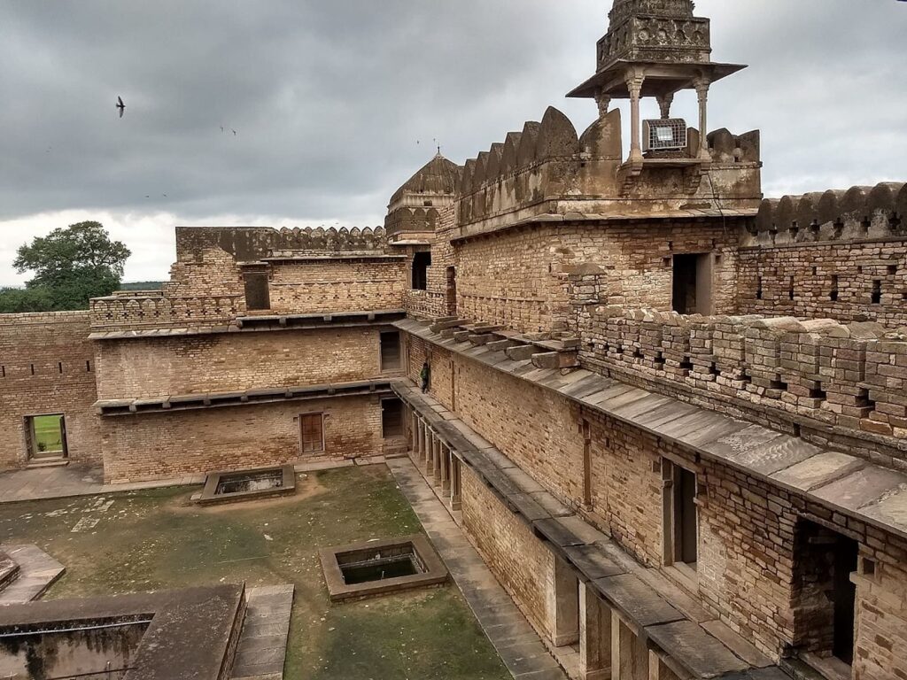
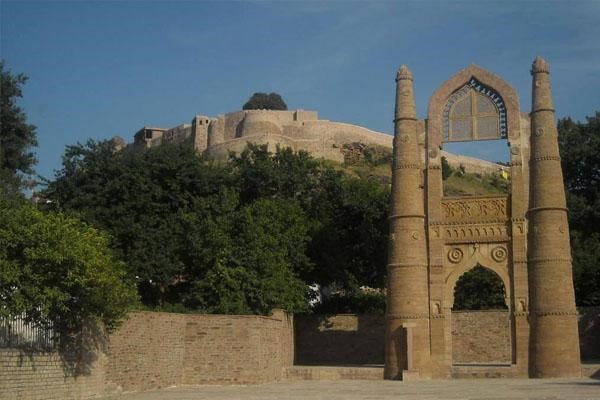
- Dominating the skyline of this lovely old town is a vast Mughal fort known as Chanderi fort. Its main gate is known as the “Khooni Darwaza”.
- Chanderi fort is situated on a hill 71 meter above the town. The fortification walls were constructed mainly by the Muslim rulers of Chanderi.
- To the southwest of the fort there is a curious gateway called katti-ghatti made through a hill side. Chanderi is famous for its hand-woven Chanderisarees.
- It is a renowned centre for traditional weavers of saree. The Chanderisarees have sophistication hard to match. The Chanderi saree is a common name in middle & rich societies and is in high demand everywhere.
- At a distance of 19 km from present Chanderi town is situated the Buddhi (old) Chanderi. BuddhiChanderi is situated on the banks of Urvashiriver.
- It is believed that the Chaidnagar mentioned in Puranas is same as Buddhi Chanderi. There is a myth that when Raja Nala left Damayanti asleep in the forests of Narwar she moved through dense forests and reached Chaidnagar protecting herself from wild animals.
- The route through forests from Narwar to Chanderi is very short. A number of 9th and 10th century Jain temples are there in BuddhiChanderi attracting thousands of Jain pilgrims from all over the country.
- View of Chanderi town from QilaKothi. The Chaubisi Jain temple with 24 shikharas, installed in 1836 by BhattarakaHarichand of Sonagir, is in the center
- The Chanderi area has been a major center of Jain culture. It was a major center The Chanderi area has been a major center of Jain culture. It was a major center of the Parwar Jain community.
- There are a number of Jain places nearby- Gurilagiri (7 km), Aamanachar (29 km), Bithala (19 km), Bhamon (16 km), Khandargiri (2 km), Thuvanji (22 km) and Bhiyadant (14 km), and Deogarh, Uttar Pradesh (20 km, across the border).
HISTORY
- Chanderi is mentioned by the Persian scholar Alberuni in 1030. Ghiyasud din Balban captured the city in 1251 for Nasirud din Mahmud, Sultan of Delhi. Sultan Mahmud I Khilji of Malwa captured the city in 1438 after a siege of several months.
- In 1520 Rana Sanga of Mewar captured the city, and gave it to MediniRai, a rebellious minister of Sultan Mahmud II of Malwa. The Mughal Emperor Babur captured the city from MediniRai, and in 1540 it was captured by Sher Shah Suri, and added to the governorship of Shujaat Khan.
- The Mughal Emperor Akbar made the city a sarkar in the subah of Malwa. The Bundela Rajputs captured the city in 1586, and it was held by Ram Sab, a son of Raja Madhukar of Orchha.
- In 1680 Devi Singh Bundela was made governor of the city, and Chanderi remained in the hands of his family until it was annexed in 1811 by Jean Baptiste Filose for the Maratha ruler DaulatRaoSindhia of Gwalior.
- The city was transferred to the British in 1844. The British lost control of the city during the Revolt of 1857, and the city was recaptured by Sir Hugh Rose on 14 March 1858.
- Richard Harte Keatinge led the assault, for which he was awarded the Victoria Cross. The city was transferred back to the Sindhias of Gwalior in 1861, and became part of Isagarh District of Gwalior state.
- After India’s independence in 1947, Gwalior became part of the new state of Madhya Bharat, which was merged into Madhya Pradesh on 1 November 1956.
AKBAR’S DESCRIPTION OF CHANDERI
- According to Ain-e-Akbari, the autobiography of Akbar, Chanderi had 14000 stone houses and boasted of 384 markets, 360 sapcious caravan sarais (resting place) and 12,000 mosques.
- Before proceeding to the individual monuments of Chanderi it may be of interest to the visitor to know certain essential characteristics of its historic architecture.
- A vast majority of the exiting standing monuments at Chanderi were raised in the the years between 1312 A.D. to 1687 A.D.
- These could be broken down into three main groups,Islamic architecture from the period of the Sultan’s of Delhi, the Mughal period, and then which comprise the majority, the Malwa Indo-Islamic.
- Also there are monuments that are a mixture of these styles.
- Chanderi has a number of ancient Hindu and Jain temple ruins, fragments, statues, and idols in modern and medieval temples which by style and speculation date probably to the 10th to 13th centuries (no inscriptions on these statues and idols have been found to confirm their dates).
- Chanderi has over 1000 mosques, over 1000 wells and ponds, 100s of tombs, 100s of temples, and many other monuments, haveli palaces, gates, and other constructions. In this chapter are listed some of the most famous.
How to reach Chanderi?
How to reach Chanderi By Air?
- The nearest Domestic Airport is the Gwalior Airport from the city, roughly five hour drive from Chanderi. It is well connected with the cities like Delhi and Mumbai via Air India flight.
- The second nearest Airport is Devi Ahilyabai Holkar Airport, Indore, roughly 380 Kms from the city.

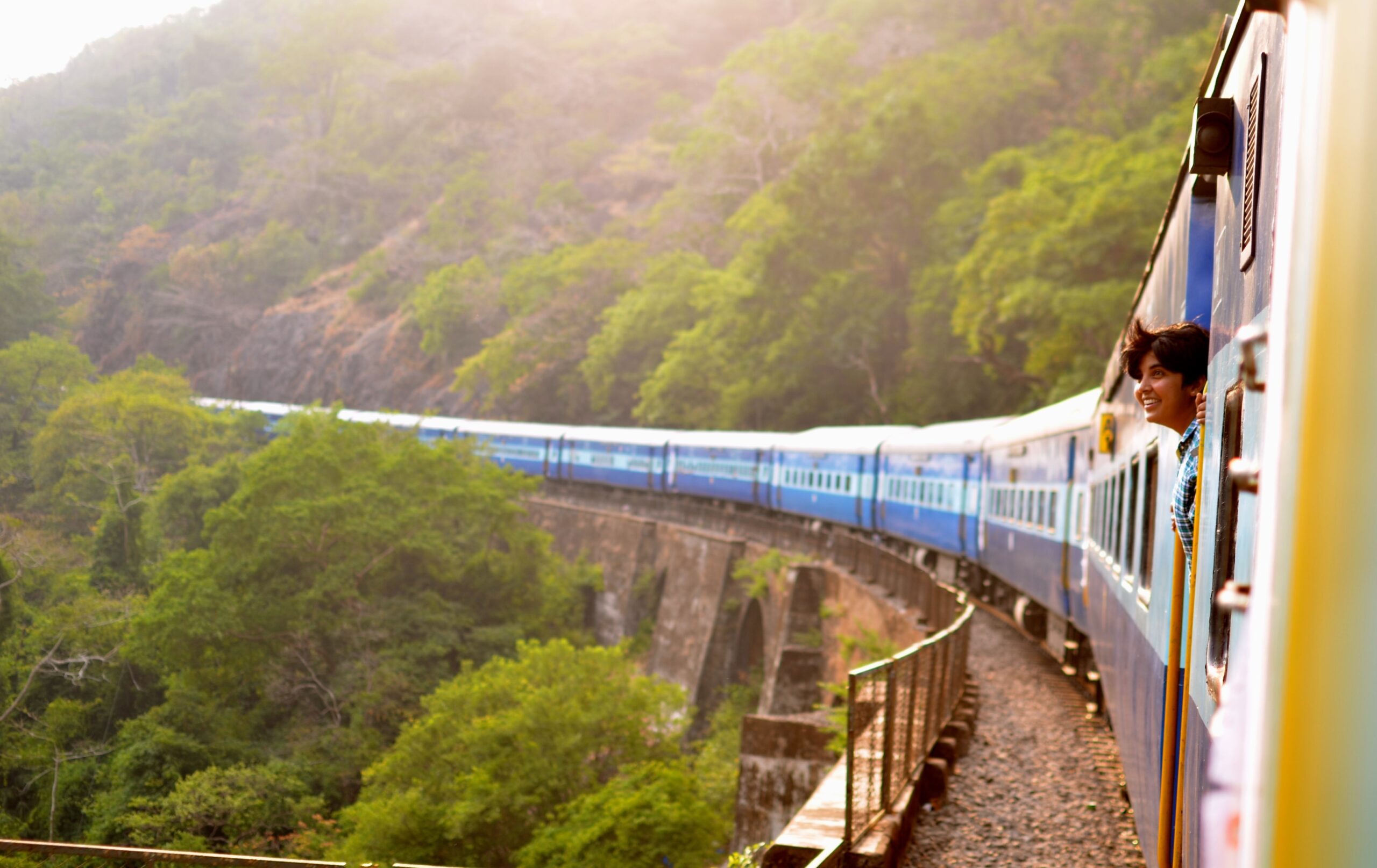
By Rail
- The nearest Railway Station is Lalitpur Railway Station, around 36 Kms from Chanderi.
By Road
- Chanderi is 37 Kms from Mungaoli, 39 Kms from Lalitpur, 44 Kms from Isagarh, 54 Kms from Ashok Nagar, 100 Kms from Guna, 148 Kms from Sagar, 306 Kms from Jabalpur, 354 Kms from Ujjain and 385 Kms from Indore and is well connected.

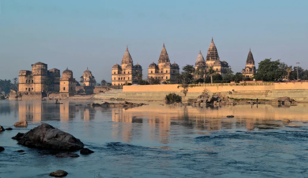
Betravati River, Chanderi
Betwa River
- The Betwa or Betravati is a river in Northern India, and a tributary of the Yamuna.
- It rises in the Vindhya Range just north of Hoshangabad in Madhya Pradesh and flows north-east through Madhya Pradesh and Orchha to Uttar Pradesh.
- Nearly half of its course, which is not navigable, runs over the Malwa Plateau.
- It is surrounded by hills southwest of the Betwa River. Chanderi is surrounded by hills, lakes and forests and is spotted with several monuments of the Bundela Rajputs and Malwa sultans.
- It is famous for ancient Jain Temples.


Trips
& tours
Choose M.P Holidays®
- Approved by “The Ministry of Tourism” (Approval No: 2203270HE874)
- “The Official No.1 Channel Partner” of M.P Tourism (Registration No: MP-TOUR-20221/131888)
- We are Awarded “The Best Travel Agent” by M.P. Government for the three consecutive years. (2016, 2017 and 2018)
- Having offices at
- Surat
- Indore
- Ahmedabad
- Pachmarhi
- Nagpur
- Kanha
- Discover Madhya Pradesh from major cities like Surat, Ahmedabad, Delhi, Mumbai, Nagpur, Pune and beyond—experience the best of India, no matter where you start.
- Own resort at Madhya Pradesh.

Certificate of Excellence for Year 2016

Certificate of Excellence for Year 2017

Certificate of Excellence for Year 2018

With Hon'ble Chief Minister Shivraj Singh Chauhan
